Getting High in Ixchiguán
Like Shangri-La, the name beckons from the maps–enticing, mysterious and alluring: Ixchiguan! I had noticed the place many years ago, and I was always looking for someone who could tell me more about this far-flung outpost. Ask anyone on the street in La Antigua Guatemala if they know anything about Ixchiguan and 99-to-1 they will say that they’ve never heard of it. The only people I have encountered who know of Ixchiguan are hardcore mountain climbers who briefly visited it on their way to scale Guatemala’s highest peaks.For years I entertained the idea of exploring this little-known region in the north. Finally I found the opportunity, and away we went aboard my land-yacht, cruising into the remote western reaches of the Cuchumatanes Mountains.
San Cristobal Ixchiguan is one of 29 municipalities that comprise the Department of San Marcos. It is located 270 kilometers northwest of Guatemala City. All but a few stretches of the highway are now paved.
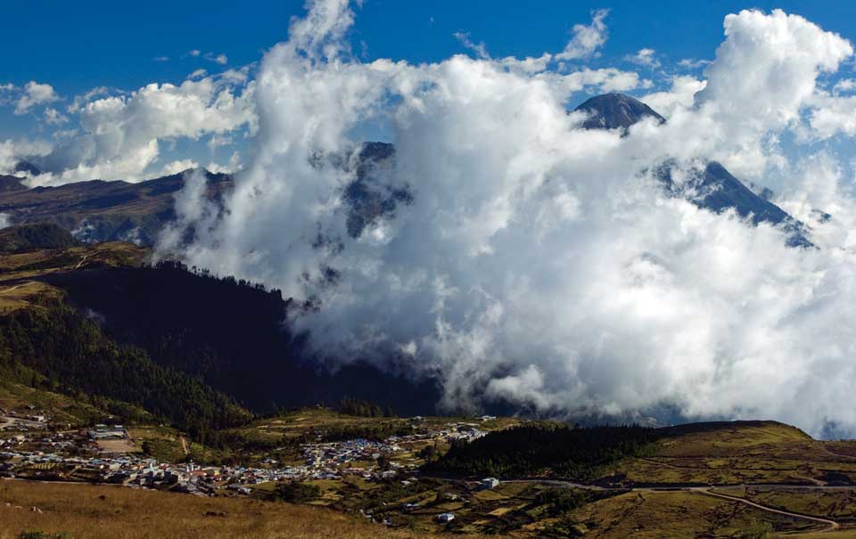
The most outstanding feature of Ixchiguan is that it is situated on a high plateau 3,200 meters above sea level, making it the highest town in Central America and the second-highest population center in Latin America, after La Paz, Bolivia. And it is high!
The Cuchumatanes are part of the Sierra Madre, the volcanic mountain range that fringes the Pacific Ocean along the entire length of the American hemisphere. Locally the mountain is known as the Cerro Cotzic. From here you can enjoy some of the most spectacular views in all of Guatemala and really appreciate the immensity of the isthmus’ highest volcanoes: Tacana and Tajumulco, 4,060 and 4,220 meters, respectively (13,320 and 13,845 feet). The town of Ixchiguan is surrounded by strangely-shaped mountains and hills, and dozens of rivers and streams meander through the cool alpine forests and tundra-like “quasi-paramo” grasslands.
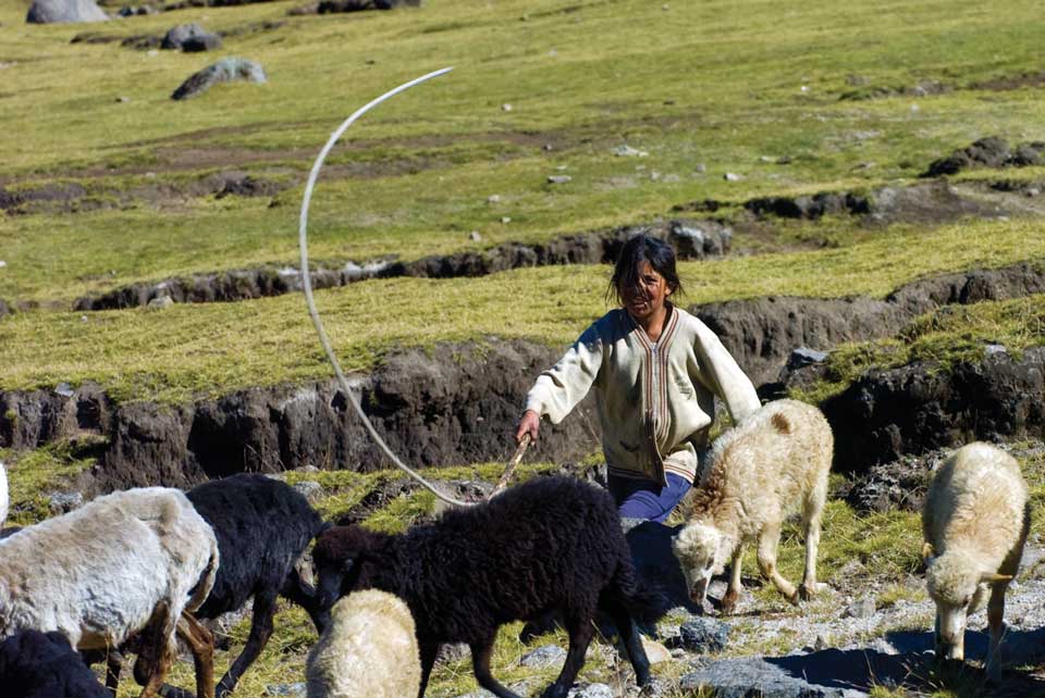
Here it is too high and cold for the cultivation of corn or even wheat, so the local population of some 25,000, nearly all of whom are of the Mam-Maya tribe, eke out a living pasturing sheep. The principal rivers are the Suchiate, which serves as the border between Mexico and Guatemala as it makes its way to the Pacific, and the Grijalva, which turns into the rivers Selegua and Cuilco on their way to the Atlantic side of the country.
Adventurous travelers who wish to experience the highest road in Central America should drive to Quetzaltenango and then on to the capital of San Marcos at an elevation of 2,000 meters. From here the climb begins up into the Cuchumatanes.
Ixchiguan is only 50 kilometers from San Marcos but it will take you several hours as you drive along the steep, winding road, occasionally damaged by landslides and washouts. As always, whenever you head way off the beaten path in Guatemala you should ask locals for information and advice concerning road conditions.
Our ascent was slowed considerably because an hour out of town, at an elevation of about 2,700 meters, we were suddenly enveloped by a cloud bank, reducing visibility to no more than 10 meters. As we crawled along up the endless switchbacks the temperature fell to near freezing. Due to the clouds we did not see much during the trip up but that only added to the mystery.
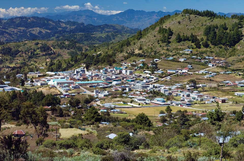
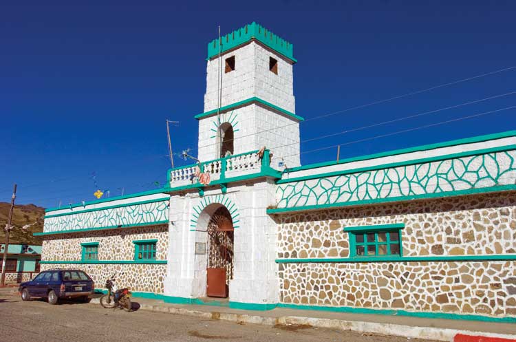
When we finally made it to Ixchiguan, we were in a freezing-misting rain and opted to camp adjacent to the gas station on the outskirts. Thankfully my camper has a heater, which was much appreciated that evening. The manager greeted us in English! As we were to find out over the coming days, Mam-Maya is the language spoken by the inhabitants, but English is almost as common as Spanish in this district, as many of the people have gone to work in the States.
Dawn came with the most brilliant blue sky above and not a cloud present: a perfect day to explore the area. The town itself is pretty small and has only one rustic hotel. We took a drive to the north toward the town of Tacana to check out the highest viewpoint at a breathless 3,500 meters. From here you get the most amazing vista of Tajumulco Volcano and the entire mountain range down to the coastal plain. Absolutely spectacular!
Another enjoyable side trip is to the little town of San Jose Ixjoyon Ojetenam, where there is a park used by locals for picnicking. The park includes a small lagoon stocked with mojarra, a fish that makes for a delicious fresh-cooked lunch.
If you’d like to experience a white Christmas in Guatemala, the best place would be Ixchiguan, where snow is not unheard of. The nights are freezing cold but the days, in the dry season, are flooded with the most intense sunshine. The locals will be quite surprised at your presence but we found them to be extremely warm and hospitable.
When you visit Ixchiguan the hands of time turn back several decades, it is a land where magic is alive and well and where the spirit of the people shines outward, welcoming one and all.