Visiting El Mirador – A Dream Come True!
There are no roads to El Mirador intentionally to deter looters from the area. We arrived by helicopter and met other visitors who had walked through the rainforest trails for two days to get there.
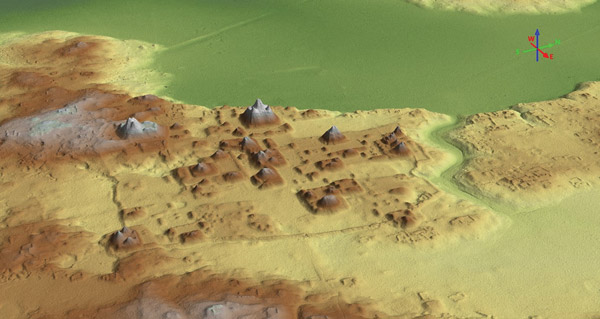
El Mirador mapped in 3D (copyright FARES-USA)
Flying over one of the few virgin rainforests left on the planet was breathtaking. Off in the distance, La Danta Temple, the oldest and largest pyramid in the Maya world, can be seen for miles as we approached.
National Geographic placed the Maya in the news recently with the exciting information about 60,000 structures mapped in Mesoamerica through LiDAR – short for “light detection and ranging.” This laser scanning allows buildings to be mapped in 2D and 3D without the vegetation that has hid the Maya temples for centuries. The team at the Mirador-Calamuk Basin, the largest Maya complex in the world, has been using LiDAR to enhance decades of work. A visit with the project director, Dr. Richard D. Hansen, and archaeologist, Carlos Morales Aguilar, brought this incredible project to life.
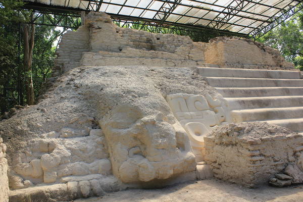
Stucco detail at Jaguar Paw Temple
Learning about the decades of work by the Foundation for Anthropological Research & Environmental Studies (FARES), we had ancient Maya history at our fingertips. As quoted from Mirador by Richard D. Hansen and Edgar Suyuc L., “La Danta Complex is one of the most impressive yet representative architectural examples of the Preclassic Maya world … Undoubtedly, planning and organizing a city such as El Mirador required millions of days of manual labor, in addition to industrial quantities of stone and mortar as materials for walls, floors, constructive fill, pigmentation, etc. … Hansen has estimated 2,816,016 cubic meters of fill.”
Located in the far northern reaches of Petén, El Mirador basin was at its height from 300 BC to 100 AD, although the Maya were in the area as early as 2600 BC. Huge causeways connected the sprawling Maya complex. Forty meters wide and up to four meters high, these are easily visible now through the LiDAR technology. They extended 3,500 kilometers, including routes between El Mirador, La Isla, Nakbé, El Chiquero, El Tintal, Caraol and possibly Wakná and Xulnal.
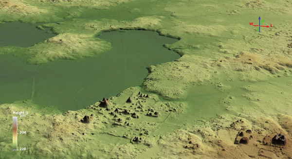
El Mirador mapped in 3D (copyright FARES-USA)
After climbing 72 meters to the top of La Danta where one can clearly see “forever,” we visited the Jaguar Paw and saw excavations by the Mirador team. Huge masks bring us face to face with the ancient Maya. This temple is appropriately named, as the area has more wild jaguars than any other on the planet. Then off to the most recent discoveries with the intricate waterways and water systems featured in the CNN special where Dr. Hansen pointed out the Preclassic version of the Popol Vuh – the Maya creation. The frieze dates from 300 BC and is 25 meters long with three horizontal panels. WOW! We were so excited to see the most recently consolidated panel – not able to photograph it until its inauguration by the president of Guatemala.
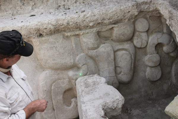
Dr. Richard D. Hansen brings the importance of the Frieze to life with
details including the Popol Vuh.
Stay tuned for more excavations, as the FARES team will be working again this summer. Why would they work in the raining season? Water of course! All rain water is collected and put to use today. Also stay tuned to the Travel Channel, which will air a special on May 30. Funds are needed to preserve this heritage, as the Guatemalan government recently stated that it is does not have the resources to do so.
Donations are welcome at fares-foundation.org
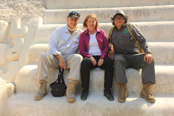
Richard Hansen, Elizabeth Bell and Carlos Morales Aguilar on the steps of the Jaguar Paw Temple.

Revue article: GUATEMALA INSIGHT
by Elizabeth Bell, author/historian. AntiguaTours.net