Walking La Antigua
-
- Walking La Antigua
-
- Walking La Antigua
-
- Walking La Antigua
by Paul Van Houten
The good news is that La Antigua Guatemala is a relatively small town and most stores, restaurants, markets, sights, ruins, and lodging are within walking distance of each other. The town is flat and the streets are straight, laid out in a grid matching the compass points.
Volcán de agua is directly south and visible from many streets.
There is logic to the layout of the town. Streets (calles) & avenues (avenidas) are numbered. In relation to central park, those going east-west are calles and include east (oriente) and west (poniente)—for instance, 6a calle poniente #2 is west of the park. Those going north-south are called avenidas and include north (norte) or south (sur). All east-west, north-south names change at central park. The park is bordered by 4th and 5th calles and 4th and 5th avenidas.
If you understood the explanation above skip the next paragraph. No? OK. Here’s a way to help you remember the layout of calles and avenidas.
Stand in the middle of central park facing the fountain La Fuente de las Sirenas (water coming out of the sirens breasts, you can’t miss it). With your back to volcán de agua stretch both arms out to your sides parallel to the ground. I know this looks silly, but it’s a sure fire formula. Your left arm represents “calles poniente” and your right arm represents “calles oriente.” Fourth calle borders the park in front of you, and 5th calle borders the park behind you. Next, turn 90 degrees to your right (keep your arms out). You are now looking at the cathedral. Your left arm represents “avenidas norte” and your right arm represents “avenidas sur.” Fourth avenida borders the park in front of you and 5th avenida borders the park behind you.
Wow! That makes so much sense! So why is it difficult to follow and find addresses in Antigua?
Some calles and avenidas have other names; 1st calle poniente is also known as “Alameda Santa Rosa,” Fifth avenida norte is known as “Calle del Arco,” and so forth.
Calle and avenida name signs, when they do exist, are flat against the wall near the corner.
And, you can always ask for directions. Many people, who look like they know where they are, speak some English and/or Spanish. You can’t predict language proficiency by looking at a person. Some people who speak English and/or Spanish will not understand English and/or your Spanish. Asking directions is the easy part. The hard part is understanding directions (or is it giving directions?). You can always start your trip over if you can get back to central park.
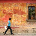
Lodging and store names are also flat against the building walls and can’t be seen walking towards them along the sidewalk. Sometimes they are on small sandwich boards within the doorway. It’s better, while walking, to watch for a shop across the street rather than on the side where you are walking.
So once you’ve mastered the avenidas (norte and sur) and the calles (poniente and oriente), now comes part II.
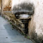
Antigua sidewalks are very narrow, one or two persons wide and often one to two feet high (sometimes more) above the street level. If you walk in a group some of you will need to walk in the street next to the sidewalk, jumping up to the sidewalk from time to time to avoid a bus, car, truck, horse-drawn carriage, motor scooter/cycle, or tuk-tuk or any combination of vehicles.
The sidewalk surfaces and materials composition are uneven and change (up or down, rocks in cement, cement only, dirt, etc.) from building to building with numerous opportunities to trip or slip.
You also share the sidewalks with signposts (not street name signs), lampposts and window balconies. Everyone over 5’ 5” (approximately) needs to be alert to ducking for some of the low signs. The window balconies (balcones) of stores and homes are made of cement frames and wrought iron that stick out over the sidewalk about a foot.
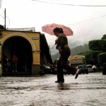
Also, the streets’ surface cobblestones are comprised of many very different sizes and heights. Walking in the street or crossing the street, you need to pick large rocks to step on, much like traversing a dry stream bed (unless it’s the rainy season). In the rainy season there is one more challenge, puddles give motorists many opportunities to splash pedestrians. Remember: If it can happen it will happen.
But mind you, despite the challenges of navigation, I’m not complaining one bit because La Antigua, Guatemala, a World Heritage Site, is the most beautiful colonial city in the world. At least I think so!